Calibro’s logical approach to seeing constraints as an opportunity assists in achieving a desirable solution that is communicated clearly and robustly to ensure the projects are driven forward successfully.
PROJECTS
PROJECTS
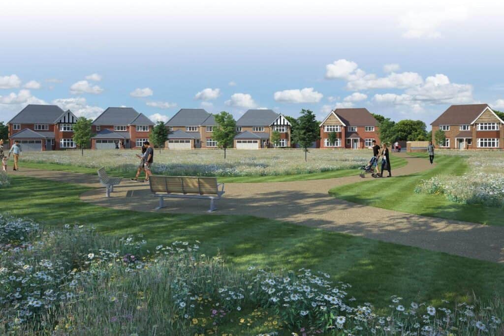
Project: Residential, 500 new homes
Location: Failand, North Somerset
Client: Harrow Estates, Redrow PLC
Services: Transport planning, drainage and flood risk

Calibro’s full suite of services are currently engaged in the promotion of a sustainable development of 500 homes on land around the village of Failand in North Somerset, under emerging North Somerset Local Plan. The site would need to be removed from the greenbelt to allow its allocation in the Local Plan. Under the requirements of the National Planning Policy Framework, only the most sustainable sites in the greenbelt may be considered for release.
For this, we used a unique analytical tool which has been developed by Calibro over the course of ten years. Our approach to this project was described by one transport expert as a potential ‘game changer for the industry’.
Failand lies just south-west of Bristol on a key transport corridor. However, the three Failand sites are in the Green Belt, where the default position is that development is not allowed. Exceptions focus on targeting the ‘most sustainable’ sites, for which there is currently no UK policy definition. Planning permission for an earlier scheme had been refused.
Calibro was initially appointed to promote the development as part of the West of England Joint Spatial Plan (JSP), which involved four councils in the region (including North Somerset), to coordinate where new housing and infrastructure should be built.
When the JSP was rejected by the Planning Inspectorate, Harrow Estates retained us to show North Somerset Council how Failand could help it to deliver its Local Plan aims; and provide pioneering, evidence-led analysis showing that Failand should rank high on the list of the area’s ‘most sustainable’ sites, to help address its Green Belt status.
Our rigorous analytical work, first quantifying the sustainability of the location and then developing transport strategies and cost-effective solutions to maximise that sustainability, means the benefits of our proposals extend well beyond the three sites. Ultimately, our evidence demonstrates that Failand can be an effective part of North Somerset’s Local Plan vision.
Nick Small, Stagecoach’s Head of Strategic Development and the Built Environment, said of Calibro’s analytical REVEAS tool: “This is potentially a game changer for the industry, and it’s a real privilege to be in sight of it at this pioneering stage.”
Sustainability is now at the front and centre of development planning policy. Our consultancy is exceptional in that we have used the past years to develop a rigorous, logical way to measure sustainability. Our modelling has been developed around the NPPF three strands of sustainability (Economy, Environment and Social) to ensure it provides metrics that establish a clear evidence base against the aspirations of government policy.
Factors include a weighted analysis of facilities such as workplaces and GP surgeries, and the types of transport used to access them. As a result, we can map the density of job opportunities; identify the number of jobs that are accessible per gram of carbon dioxide emissions; and work out the number of jobs accessible per pound spent in travel time. It is not just a binary yes/no answer: we provide a numerical, evidence-led way to rank the sustainability of an area (or of individually competing sites).
For the JSP we undertook detailed analysis of all 28 competing sites, which included 50 million individual calculations. We were delighted to hear one of the stakeholders – Stagecoach – describe this analysis to the Planning Inspectorate as ‘ground-breaking’. For the subsequent North Somerset consultation we developed a lighter touch, and a less site-specific approach, in a ptal style heatmap – focusing on planning principles and comparing strategies.
The region has many environmental constraints to development: designated sites of special scientific interest, areas of natural beauty and flood zones. So naturally these have to be excluded from our model. What was left was our Relative Employment Versus Emissions Accessibility Score (REVEAS), a pioneering system developed by our Transport Team and inspired by Transport for London’s relatively simple, go-to spatial map of public transport accessibility levels (PTAL). REVEAS proved so powerful in its easy-to-understand format, that it has since become the core of all our Local Plan submissions and public relations strategy.
Using the REVEAS modelling to demonstrate the ingrained sustainability credentials of the site, there was a need to unlock this potential within the masterplan. We have therefore been working hard with key partners that include Sustrans (the national cycle charity), Brompton Bike Hire, Enterprise Car Clubs, and others, to evaluate the potential to create a connected village.
Whilst work continues, support has been garnered from Sustrans who have agreed that there is not only the potential to create a cycle connection from the site onto the existing National Cycle Network (NCN) Route 33, known as Festival Way, but that this route may be formally integrated as part of the NCN once constructed. In this context, the promotion of the site now benefits from the potential to be served by nationally significant infrastructure – something we haven’t seen before!
Combining this with a detailed on-site SuDS strategy to merge the various requirements drainage, flood risk and landscape, we have supported the wider consultant team in providing a truly exciting new space that not only avoids being a ‘bolt on’ to the existing village – something that happens to often – but which creates much needed open space for existing village residents to use and enjoy.
Calibro’s logical approach to seeing constraints as an opportunity assists in achieving a desirable solution that is communicated clearly and robustly to ensure the projects are driven forward successfully.